In the summer of 1974, a well driller named Kenneth Pace drove his drilling rig down a gravel road in Shannon County, Missouri, parked it in the farmyard of the Gentry place outside of Eminence, spent two days punching holes in the Ozark limestone, and declared the property dry. “There’s no water here, Mr. Gentry, not at any depth I can reach. I drilled three test holes to 200 ft each, hit solid dolomite at 80 ft, fractured limestone below that, and no water-bearing formation anywhere in the profile. The geological survey maps confirm it. This ridge is above the regional water table. You’re sitting on top of a hill made of rock that doesn’t hold water.”
Coy Gentry was 51 years old. He had been farming 160 acres on this Ozark ridge since 1963. When he had bought the place from a widow who was moving to Springfield, the farm had a cistern that collected rainwater and a seasonal creek that ran from February to June and went dry every summer. For 11 years, Coy had managed hauling water from a neighbor’s spring 2 miles away during the dry months, rationing what the cistern held, praying for rain in July and August when the livestock needed water most. But 1974 was a drought year.
The creek had gone dry in April instead of June. The cistern was empty by May. The neighbor’s spring, which had never failed in living memory, slowed to a trickle in June and stopped entirely in July. For the first time in his life, Coy Gentry had no water. Not reduced water, no water. 28 head of cattle, a vegetable garden, a household of three, and not a drop coming from anywhere.
He had called Kenneth Pace because Kenneth was the best well driller in the Ozarks. 20 years of experience, a $60,000 rotary drilling rig that could punch through solid rock to 400 ft, a shelf full of geological survey maps and aquifer charts. Kenneth knew where the water was in Shannon County the way a surgeon knows where the organs are. By education, by experience, by the maps. And the maps said there was no water on Coy Gentry’s Ridge.
“What do I do?” Coy asked. “You can pipe water from the valley. There’s a good well on the Langston place 3 miles east. You’d need to run a line and install a pump. Cost you about $8,000.” “I don’t have $8,000.” “Then you can haul water, or you can sell the cattle and farm dry, or you can sell the place. I’m sorry, Coy. This ridge doesn’t have water. The geology doesn’t allow it.” Kenneth loaded his rig and drove away.
Coy stood in his farmyard looking at the three drill holes. Neat, round, 200 ft deep, bone dry. And thought about his father. Let me tell you about Coy’s father because Otis Gentry is the reason this story has a different ending than the one Kenneth Pace predicted. Otis Gentry was born in 1898 in Shannon County. He never left. He never went to school past the sixth grade. He never read a geological survey. He never looked at an aquifer map.
What Otis knew about water, he had learned from his own father, who had learned it from his father, who had homesteaded in the Ozarks in the 1850s and dug the first wells in Shannon County by hand. The Gentrys were well diggers, not drillers, diggers. Men who went into the earth with a pick, a shovel, a bucket on a rope, and the knowledge of where to dig that came not from maps, but from watching the land. Three generations of Gentrys had dug wells across the Missouri Ozarks.
And they had developed a method that no geological survey had ever documented because no geologist had ever asked them about it. The method was simple in description and extraordinarily difficult in practice. It was called reading the ridge. Let me explain because the science behind it is real. Even though the men who discovered it never called it science. The Ozark Plateau is karst geology. Limestone and dolomite riddled with caves, sinkholes, springs, and underground rivers.
Water in karst doesn’t behave the way it behaves in normal rock. In sedimentary formations, sandstone, shale, water sits in predictable layers. You drill down, you hit the water table, you install a pump. The geological survey maps show where the water table is and the driller follows the map. In karst, the water table is a fiction. Water doesn’t sit in layers. It flows through fractures, channels, and caverns dissolved into the limestone over millions of years. The water is there. The Ozarks are full of it. Some of the largest springs in North America emerge from Ozark limestone.
But it moves through specific pathways that a drill bit might miss by 10 ft and never know. Kenneth Pace’s three test holes had punched through solid dolomite and fractured limestone without hitting a water-bearing fracture. That didn’t mean there was no water on the ridge. It meant the drill had missed the fractures. In karst geology, drilling is like throwing darts at a target you can’t see. You might hit the bull’s-eye. You might hit the wall. The Gentry method, reading the ridge, was a way of finding the fractures without drilling.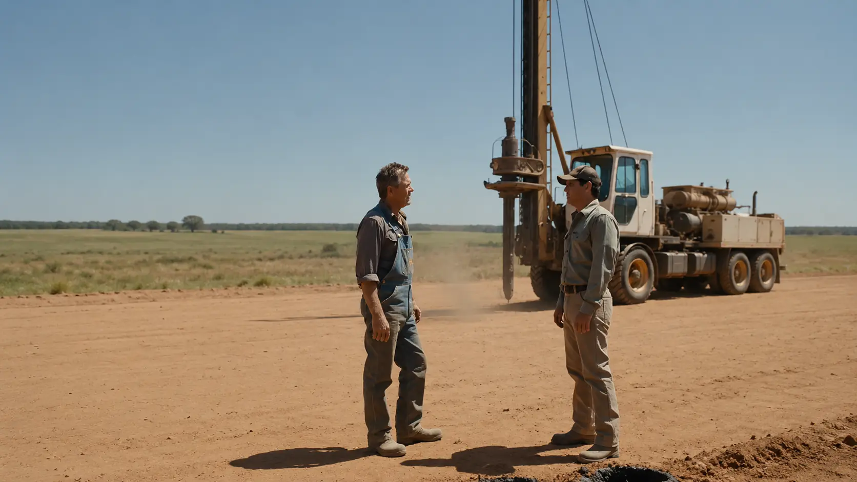
Otis had taught Coy the signs when Coy was a boy, walking the Ozark hills together the way other fathers and sons went fishing. “Water leaves tracks,” Otis told Coy. “Even when you can’t see it, the water’s talking to you. You just have to know how to listen.” The signs were subtle but consistent. Vegetation patterns. Certain trees, particularly sycamores, willows, and red cedars, grew along fracture lines because their roots could reach moisture that other trees couldn’t. In winter, frost patterns on the ground told the story. Areas above fractures stayed warmer because the groundwater moderated the temperature and the frost melted there first.
In summer, patches of green grass on an otherwise brown hillside marked places where moisture was seeping upward through capillary action in the rock. The most reliable sign was the seep. A damp spot on a rock face. A patch of moss where no moss should grow. A place where the limestone sweated in the summer. Not enough water to flow, but enough to leave a stain. Otis called these the land’s fingerprints. Each one marked a fracture, and where fractures intersected, where two or more moisture traces converged, that was where you dug, not drilled.
Dug by hand with a pick and a shovel because a drill bit is 6 in wide and can pass between fractures without touching them. A hand-dug well is 4 ft wide. It opens a cross-section of rock that’s eight times wider than a drill hole. If a fracture exists within 2 ft of your center line, a hand-dug well will find it. A drill bit won’t. That was the secret Kenneth Pace didn’t know. His $60,000 rig punched 6-in holes through the rock like a needle through fabric. Fast, precise, and likely to miss the thread. The Gentry method opened the rock like tearing the fabric apart. Slow, brutal, and impossible to miss what was inside.
Let me tell you about the dig because Coy Gentry started digging the day after Kenneth Pace drove away, and he didn’t stop for 6 weeks. Coy walked the ridge, not quickly, slowly, the way his father had taught him. He walked every contour line looking for the signs. He found the sycamore first, a single mature sycamore growing on the northwest slope of the ridge, 200 ft from the farmhouse, in a spot where no sycamore should have been. Sycamores need reliable moisture. The fact that this tree was alive and healthy on a ridge that a well driller had declared dry meant one thing. The tree’s roots had found water that the drill bit had missed.
He looked for the secondary signs around the sycamore. He found a frost melt pattern from the previous winter. He had noticed it in January without understanding what it meant. A patch of ground near the sycamore’s base where the frost disappeared 3 days before the surrounding ground. Temperature differential. Groundwater warmth rising through a fracture. He found the seep in July, a damp streak on a limestone outcrop 12 ft down slope from the sycamore. Not flowing. Just damp. A dark stain on gray rock where moisture was wicking out of a fracture and evaporating in the summer air.
In a normal year, the seep would have been invisible. The surface moisture would have been lost in the general dampness of spring. But 1974 was a drought year. Everything was dry. The seep stood out like a beacon. Coy marked the spot 6 ft up slope from the seep. Directly below the sycamore at the convergence of the frost pattern and the vegetation marker. That was where the fracture crossed. That was where the water would be. Kenneth Pace had drilled his three test holes on the flat top of the ridge where the geological survey maps indicated the most likely aquifer access. He drilled where the maps said to drill. Coy was going to dig where the land said to dig. And the land was telling a different story than the maps.
Coy started digging on July 12th. He dug alone. He used a pick, a shovel, a pry bar, and a 5-gallon bucket on a rope for hauling debris. His Farmall Super M sat in the barn, useless for this job. There’s no machine that digs a well. A well is dug by a man in a hole with a pick, one strike at a time, for as many days as it takes. The first 10 ft were soil and weathered limestone, easy digging by Ozark standards. The rock was soft enough to break with a pick, and Coy hauled the debris up in the bucket, 10 loads per foot, 100 loads per day. He lined the walls with dry-stacked limestone as he went, the same technique his grandfather had used, creating a permanent shaft 4 ft in diameter that wouldn’t collapse.
At 12 ft, he hit solid dolomite, the hardest rock in the Ozarks. The pick bounced off it like hitting iron. Each strike removed a chip the size of a quarter. Progress dropped from a foot a day to 6 in a day, then 4 in, then 3. The neighbors knew what Coy was doing. The sound of a pick striking dolomite carries across an Ozark hollow the way a church bell carries across a valley, a rhythmic ringing tone that went on from dawn to dark. Men drove past on the gravel road and saw the growing pile of rock chips beside the hole. They stopped to watch. They offered advice. They offered pity. “Coy, Kenneth Pace drilled three holes to 200 ft. There’s no water on this ridge.” “Kenneth drilled. I’m digging. Those are different things. You’re going to kill yourself in that hole. It’s July. It’s 95°. You’re swinging a pick at dolomite in a 4-ft shaft with no ventilation.” “I’ll rest when I hit water.”
The John Deere dealer in Eminence, a man named Cliff Rowland, heard about the dig and mentioned it at the feed store the way men mention things they find amusing and slightly sad. “Coy Gentry’s digging a well by hand on that ridge. One Kenneth Pace said was dry. Man’s down about 15 ft into solid rock with a pick and a bucket. I give it another week before he gives up.” “What if he hits water?” “He won’t hit water. Kenneth drilled three holes. The ridge is dry.” “Kenneth drilled 6-in holes. Coy’s digging a 4-ft shaft.” “4 ft of dry rock is still dry rock.”
Let me tell you about 20 ft because that’s where Coy found the first sign that Kenneth Pace’s maps were wrong. At 20 ft, the dolomite changed. The color shifted from uniform gray to gray with white streaks, calcite veining, which indicated water had once flowed through the rock and deposited minerals. The rock was still dry, but the calcite veins were a message from the past. Water had been here. Water had moved through these fractures at some point in geological history. The question was whether it still did. Coy dug faster, not because the rock was softer, it wasn’t, because the calcite veins gave him hope. And hope is fuel for a man swinging a pick at the bottom of a 20-ft hole in July.
At 24 ft, he found the first fracture. A crack in the dolomite running roughly north-south, 2 in wide, lined with clay and gravel, the residue of water flow. The fracture was dry at this depth, but when Coy pressed his hand against the clay inside the crack, it was cool, not cold, cool. Cooler than the surrounding rock. That meant moisture was moving somewhere below. Not here, not yet, but close. He dug through the fracture and kept going. The dolomite below the fracture was different again, darker, denser. And when Coy struck it with the pick, the sound changed. The ring became a thud. Dense rock, wet rock, rock that was holding moisture in its pores even though it wasn’t flowing.
At 28 ft, Coy’s pick struck something that sounded different from everything he had hit in the previous 4 weeks. A hollow thud. Not the ring of solid rock or the thud of wet rock. A hollow sound like tapping the side of an empty barrel. He struck again, same sound. He struck a third time and the pick broke through, water. Not a seep, not a trickle. A pressurized flow that shot up through the opening like a fire hose. Cold, clear, limestone-filtered spring water that filled the bottom of the shaft in minutes. Coy scrambled up the dry-stack walls, hauling himself hand over hand, boots slipping on the wet stone as the water level rose below him. He reached the surface and rolled onto the ground, soaking wet, panting, looking down into a shaft that was filling with water at a rate of approximately 2 gallons per minute.
He had hit a pressurized aquifer, not the regional water table that Kenneth’s map showed at 400 ft. A perched aquifer, trapped in a fracture zone above an impermeable dolomite layer, pressurized by the weight of the ridge above it. The water had been there all along, 30 ft below the surface, in a fracture that Kenneth’s 6-in drill holes had missed by less than 4 ft. 4 ft. The difference between a drill bit’s diameter and a hand-dug shaft’s diameter. The difference between there’s no water and a spring that would flow at 2 gallons per minute, 2,880 gallons per day. For the next 25 years, without stopping.
Let me tell you about the day the water came, because the news spread through Shannon County the way water spreads through limestone, finding every crack, reaching every corner. Coy’s nearest neighbor, Vernon Hicks, was the first to see. He had been driving past daily, watching the rock pile grow, expecting to see Coy give up. Instead, he saw water pouring over the lip of the shaft and running downhill into the pasture, creating a stream where none had existed an hour earlier. Vernon stopped his truck and walked to the well. Coy was sitting on the ground beside it, covered in mud and limestone dust, watching the water flow. He looked like a man who had been in a fight because he had. Six weeks of fighting rock with a pick, alone in July, while the county told him he was digging his own grave.
“You hit water.” “I hit a spring.” “A spring? On this ridge?” “Perched aquifer. Fracture zone at 30 ft. Kenneth missed it because his drill was too narrow. The fracture is about 18 in wide. His 6-in bit went through solid rock on both sides and never touched it.” Vernon looked at the water. Clear, cold, flowing steadily out of the hole at a rate that was already forming a pool at the base of the slope. “How much flow?” “2 gallons a minute. Maybe more once the shaft fills and pressure stabilizes. 2 gallons a minute is 2,800 gallons a day.” “I know what it is. It’s enough for the cattle, the garden, the house, and the neighbors.”
Vernon was quiet. Then, “I’ve been watching you dig for 6 weeks. I thought you were crazy. Everybody thought you were crazy.” “I know. You weren’t crazy.” “I was reading the ridge. My father taught me. His father taught him.” “Reading the what?” Coy pointed at the sycamore. “That tree told me where to dig. The frost pattern in January told me the fracture line. The seep on the outcrop confirmed it. The water was here the whole time. I just had to dig in the right place and go wide enough to find the fracture.”
Within a week, everyone in Shannon County knew. The farmer on the dry ridge had dug a well by hand and hit a spring. Kenneth Pace heard about it at a gas station in Eminence and didn’t believe it until he drove out and saw the water flowing with his own eyes. Let me tell you about Kenneth’s visit because it happened 3 days after the well came in. And it’s the conversation that matters most. Kenneth parked his truck beside Coy’s well and looked at the flow. Clear, cold, steady. 2 gallons a minute. He checked it with a 5-gallon bucket and his watch. He looked at the shaft. 4 ft in diameter, 30 ft deep, dry-stacked limestone walls, water flowing from a fracture zone visible at the 28-ft mark.
“This isn’t possible,” Kenneth said, not angry, genuinely confused. “I drilled three holes on this ridge, 200 ft each. 600 ft of test drilling. I hit solid dolomite, fractured limestone, and zero water. Where did you drill?” “Top of the ridge, flat ground, best access for the rig. The geological survey shows the regional water table at 400 ft. That’s what your map says.” “That’s correct. This isn’t the regional water table. This is a perched aquifer. Groundwater trapped in a fracture zone above an impermeable layer at 30 ft. The regional maps don’t show perched aquifers because they’re too small and too localized.
They exist in the spaces between what the maps can see.” “And you found it how?” “The sycamore, the frost pattern, the seep. My father called it reading the ridge. His father taught him. They’ve been finding water in the Ozarks this way since the 1850s, before geological surveys, before drill rigs, before maps.”
Kenneth walked around the well. He looked at the sycamore, healthy, green, roots reaching toward the shaft where the water was. He looked at the slope and saw the damp streak on the outcrop. The seep that Coy had used as a marker. He looked at the well itself. Hand dug, 4 ft wide, the fracture visible in the wall where the water emerged. “My drill holes were on the flat top,” Kenneth said. “This is on the slope, below the ridge line.
Perched aquifers form on slopes, not on tops. The water follows the dip of the impermeable layer, which tilts toward the valley. On the flat top, the impermeable layer is above the fracture zone. The water drains away before it can accumulate. On the slope, the impermeable layer is below the fracture zone. The water gets trapped.” “My father knew this. He didn’t call it geology. He called it watching where the trees grow.”
Kenneth was quiet for a long time. He was a professional. He drilled hundreds of wells. He had trusted maps and surveys and geological cross-sections for 20 years. And a farmer with a pick and a sycamore had found water that his $60,000 rig had missed. “I owe you an apology,” Kenneth said. “I told you this ridge was dry.
I told you the geology didn’t allow it. I was reading the map. You were reading the land. The map was wrong.” “The map wasn’t wrong. The map was incomplete. It showed what the geologists could measure from the surface and from drill cores. It didn’t show what a sycamore root can find at 30 ft because nobody ever asked the sycamore.” Kenneth laughed. It was a genuine laugh. The laugh of a man who had just been taught something by a farmer that his engineering professors had never mentioned. “Nobody ever asked the sycamore. I’m going to remember that.”
Let me tell you about the drought of 1980 because that’s when Coy’s well saved more than his own farm. 1980 was worse than 1974. The driest year in Shannon County since the Dust Bowl. Every creek went dry by May. Every cistern was empty by June. Wells that had produced reliably for decades dropped to nothing as the regional water table fell below the pump depth. 14 farms in the county hauled water from the state park campground, the only reliable source, at a cost of time and fuel that was bleeding operations dry in every sense. Coy’s well didn’t drop, not a gallon.
Two gallons per minute, the same steady flow it had produced since the day he had hit the fracture six years earlier. The perched aquifer was recharged by rainfall that seeped through the ridge slowly. Over months, not days. The drought had reduced the recharge rate, but the aquifer itself held years of accumulated water in the fracture zone, insulated by 30 ft of rock from the surface evaporation that was killing everything above.
Coy opened his well to the neighbors. Six farms shared his water that summer, running hoses and tanks from his overflow, hauling 5-gallon jugs for their households, driving cattle to a trough Coy set up in his lower pasture, fed by a gravity line from the well. He didn’t charge. He said the same thing he had said to Vernon the day the water came in. “It’s enough for the cattle, the garden, the house, and the neighbors.” Six farms survived the 1980 drought on water from a well that a professional driller had said didn’t exist. Six families, 60 head of cattle, three vegetable gardens, one spring flowing at two gallons a minute from a fracture in the dolomite that a man had found because he had watched where a sycamore grew.
Cliff Rowland, the John Deere dealer in Eminence, drove to the Gentry farm during the drought to see the well. He had been mocking Coy’s dig since 1974. Digging a well by hand in solid rock, that’s not farming. That’s punishment. Now he was standing beside a well that was providing water to half the farms in the hollow while his own customers were hauling from the state park. “Coy.” “Cliff.” “I need to ask you something. In 1974 when you started digging, I said you were crazy.
Said Kenneth Pace had drilled three holes and the ridge was dry. Said you were wasting your time.” “I remember.” “I was wrong, obviously. But that’s not what I want to ask.” Cliff looked at the well, the flowing water, the hoses running to the neighbor’s property. “I want to know how you knew. How did you know there was water here when Kenneth’s drill said there wasn’t?” “I didn’t know. I believed.
My father taught me to read the land. The trees, the frost, the seeps. Every sign pointed to water here. The signs don’t lie. The maps might be incomplete. The drill might miss. But a sycamore growing on a dry ridge doesn’t lie about what its roots have found.” “You trusted a tree over a geological survey.” “I trusted what I could see over what someone drew on paper in an office in Rolla. The survey was made by men who never stood on this ridge. They mapped from above. My father read from below. The land tells you what it has if you learn its language.” Cliff nodded. He didn’t have a reply. There’s no sales pitch for a situation where a hand dug well is keeping six farms alive while the modern infrastructure fails.
Let me tell you about the wells that came after because Coy’s success changed how Shannon County found water. After the drought of 1980, farmers started coming to Coy. Not to hire him as a well digger. Coy was a farmer, not a contractor. They came to learn. To understand the reading method, to walk their own ridges with Coy, and learn to see what their fathers and grandfathers had once known before the drilling rigs made the old knowledge seem unnecessary.
Coy taught seven men to read the ridge between 1981 and 1990. He walked their properties with them, pointed out the sycamore, the frost patterns, the seeps. He showed them where to dig. Three of the seven hit water, perched aquifers in fracture zones at depths between 22 and 38 feet. The other four dug dry holes, which Coy had warned them was possible. The signs increase the odds. They don’t guarantee the outcome. A sycamore means moisture. It doesn’t always mean a spring. But three new hand dug wells on ridges that professional drillers had declared dry was enough to establish that Coy’s method worked.
The geological community took notice. A professor from Missouri State University visited Coy’s well in 1988 and published a paper on perched aquifer detection using surface vegetation indicators. The paper cited traditional Ozark dowsing methods, the professor’s term, not Coy’s, as a surprisingly reliable method for identifying fractured rock aquifer zones that conventional drilling misses. Coy didn’t like the word dowsing. It implied mysticism.
Kenneth Pace came back to see Coy in 1985, 11 years after the original dry verdict. He had been rethinking his approach since that day beside the well. He had started paying attention to vegetation when he surveyed drill sites, noting where sycamores grew, where willows clustered, where moss appeared on rock faces in unexpected places. “I’ve changed how I site my drill holes,” Kenneth told Coy. “I still use the geological surveys, but before I drill, I walk the property the way you walk it. I look for the trees. I look for the seeps. I’ve moved my drill location based on vegetation indicators on six properties since 1980.
Four of them hit water where the maps said they wouldn’t.” “You’re reading the ridge.” “I’m trying. I’m not as good at it as you. I didn’t grow up with it.” “My father wasn’t good at it when he started, either. He learned from his father. Took 20 years before he could read a hillside by walking it once. The knowledge isn’t instant. It accumulates like the water in the rock.” Kenneth smiled. “Like the water in the rock. That’s a good way to put it.” “My father said it. I just remembered it.”
Let me tell you how this ends. Coy Gentry farmed the 160 acres until 1995 when he was 72. His son, Wyatt, took over and farms it today. The well is still flowing 25 years after Coy hit the spring. The water comes at approximately 1.8 gallons per minute. Slightly less than the original two gallons, indicating a gradual decline in the perched aquifer’s recharge rate, but still more than enough for the farm’s needs. The Farmall Super M is in the barn.
Wyatt uses a modern tractor for field work, but keeps the Super M maintained. The tractor Coy farmed with for 32 years. The tractor that was parked in the barn while Coy dug 30 ft of dolomite by hand with a pick and a bucket. The sycamore is still standing. It’s taller now. The increased water flow from the exposed fracture has fed the tree’s roots for 25 years and it’s grown from a mature tree to a giant. Its canopy shades the well head. Wyatt calls it the water tree. He tells his children the story. The driller who said the ridge was dry. The farmer who trusted a sycamore. The spring that saved six farms.
Coy died in 1999 at 76. The funeral was at the Baptist Church in Eminence. Kenneth Pace was there. He had driven from West Plains, an hour and a half away, because some men deserve to be remembered by the people they proved wrong. Kenneth told one story at the graveside.
He told the story of the well, of the three dry test holes, of the day Coy hit the spring, of the phrase that had changed how Kenneth sited every well he had drilled since 1974. “Nobody ever asked the sycamore,” Kenneth said. “Coy taught me that. The land has water. The maps don’t always know where, but the trees do. And the farmers who watch the trees know what the trees know.” “Let me ask you something. Who are you listening to? The man with the map or the man with the mud on his boots?”
Kenneth Pace had a $60,000 rig, 20 years of experience, and geological surveys from the state. He drilled where the maps told him to drill. He declared the ridge dry because his instruments said it was dry, and he was wrong. Not because his instruments were bad, but because his instruments could only see what they were designed to see. A 6-in hole through rock is a keyhole. You see a sliver of what’s there and assume you’ve seen the whole room. Coy Gentry had a pick, a shovel, a bucket, and 72 years of watching the Ozarks. He dug where a sycamore grew.
He opened a 4-ft window into the rock instead of a 6-in keyhole, and he found a spring that had been there for centuries, missed by three drill holes that passed within 4 ft of the fracture without touching it. The driller trusted the map. The farmer trusted the land. The map showed what the geologist could measure. The land showed what the sycamore already knew. The well driller said there was no water. The farmer dug by hand and hit a spring at 30 ft. The sycamore had known all along. Nobody asked it until a man with a pick decided to listen.